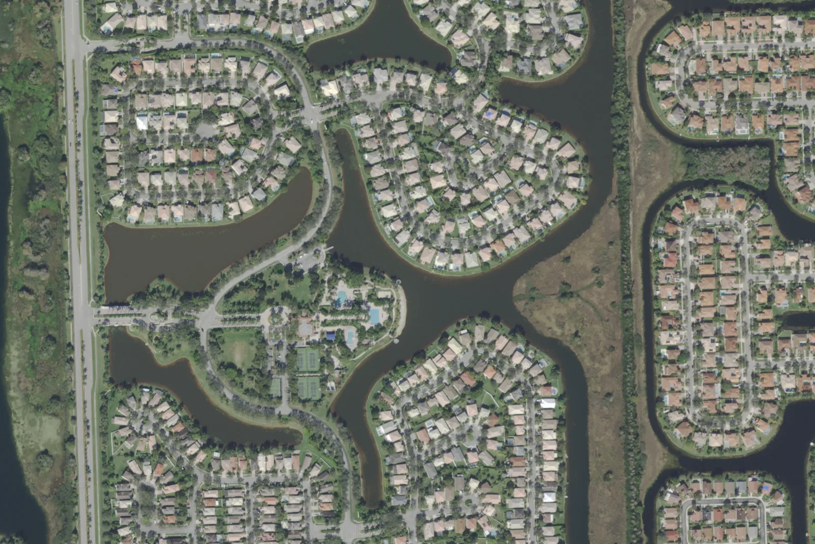
Pembroke Isles, about 400 acres east of NW 172nd Avenue in ZIP 33028, is zoned for Panther Run Elementary, Silver Trail Middle and West Broward High.
Last checked Oct. 10, 2026. Sources: the Broward County Property Appraiser’s neighborhood layer, Broward County’s address points, school boundaries and parks layer, the Florida Department of Education’s 2026 school grades, Zillow Research, Broward County Transit and OpenStreetMap.
Pembroke Isles is a neighborhood of about 400 acres on the east side of NW 172nd Avenue, between Pines Boulevard and Sheridan Street. Panther Run Elementary is inside it, and the city’s Silver Lakes Park North is just across NW 172nd Avenue. It is the easternmost area in this guide zoned for West Broward High; its neighbor to the east, Spring Valley, is zoned for Charles W. Flanagan High.
What this means for you
- Zoned high school: West Broward High for every address, an A school in Florida’s 2026 grades. Check yours with the district’s Find My School tool.
- Home value: $672,022 in ZIP 33028 in August 2026, according to the Zillow Home Value Index.
- Nearest interstate exit: I-75 exit 11, Sheridan Street, about 2.7 miles by road.
Part of our Pembroke Pines neighborhoods guide.
Where it is
In the Property Appraiser’s neighborhood layer, Pembroke Isles is one polygon of about 401 acres. NW 172nd Avenue runs along its west side, and its east side is between NW 166th and NW 167th avenues, where Spring Valley begins. It runs from Pines Boulevard north toward Sheridan Street, narrowing at the north end. Silver Lakes is across NW 172nd Avenue to the west. Broward County’s address data has about 1,250 street addresses here, all in ZIP code 33028.
Schools
How the neighborhood’s addresses fall in Broward County’s 2025-26 school boundary layers, updated March 2026, with each school’s 2026 grade from the Florida Department of Education. The percentage is the share of the possible points the school earned.
| Level | School | Share of addresses | 2026 grade |
|---|---|---|---|
| Elementary | Panther Run Elementary, 801 NW 172nd Ave. (report card) | 100% | B (60%) |
| Middle | Silver Trail Middle, 18300 Sheridan St. (report card) | 100% | A (70%) |
| High | West Broward High, 500 NW 209th Ave. (report card) | 100% | A (72%) |
Panther Run Elementary, inside the neighborhood, earned an A in 2025 and a B in 2026. Silver Trail Middle has a Southwest Ranches mailing address on Sheridan Street, and West Broward High is on NW 209th Avenue, near the city’s western edge. Confirm an address with the district’s Find My School tool. More in our schools guide.
Home values
The typical home value in ZIP 33028 was $672,022 in August 2026, down 1.2% from $680,122 in August 2025, according to the Zillow Home Value Index. The index is a modeled typical value for the middle third of homes, single-family homes and condos together, not a sale price, and it covers the whole ZIP code, which also takes in Spring Valley, Towngate and Pembroke Falls. The citywide Pembroke Pines figure was $488,121, down 1.9% on the year. More in our home prices guide.
Parks and trails
From Broward County’s parks layer and the city’s facilities pages:
- Silver Lakes Park North, 2300 NW 172nd Ave., about 25 acres just across NW 172nd Avenue, with a walking and jogging path, tennis, basketball, volleyball, soccer and five first-come pavilions.
- Academic Village, 17198 Sheridan St., a 71-acre city site with the city’s charter middle and high schools, just north across Sheridan Street.
- Silver Lakes Park South, 17601 SW 2nd St., about 25 acres, about a third of a mile southwest across Pines Boulevard.
- Pembroke Shores Park, 501 SW 172nd Ave., about 40 acres, about a third of a mile south.
More in our parks and trails guide.
Getting around
- Interstate: I-75 exit 11, Sheridan Street, about 2.7 miles by road from the middle of the neighborhood, or exit 9, Pines Boulevard, about 3.6 miles.
- City Hall: about 7.3 miles to 601 City Center Way.
- Airport: about 16.8 miles to Fort Lauderdale-Hollywood International Airport.
- These are distances measured on the OpenStreetMap road network with the OSRM routing engine, not drive times.
- Bus: Broward County Transit Route 7 (Hollywood Boulevard/Pines Boulevard) stops on Pines Boulevard, in BCT’s published schedule data for summer 2026. Check current times on BCT’s website or at 954-357-8400.
More in our getting around guide.
Homeowners associations
The Property Appraiser’s neighborhood layer records an association named Pembroke Isles for this polygon. Association rules and fees are not public records we can check; ask for the governing documents before you buy.
Groceries and everyday stores
From OpenStreetMap, on Pines Boulevard:
- Walgreens, 15911 Pines Blvd., a little under half a mile southeast
- Publix, 16024 Pines Blvd., about half a mile southeast
How we drew this area
This page uses the Pembroke Isles polygon in the Broward County Property Appraiser’s neighborhood layer, as published by Broward County GIS. Addresses and school shares come from every Broward County address point inside it with a Pembroke Pines city name, matched to the county’s 2025-26 school boundary layers on Oct. 10, 2026. Store locations are © OpenStreetMap contributors.
Frequently asked questions
What schools serve Pembroke Isles in Pembroke Pines?
In Broward County’s 2025-26 school boundary data, every address in Pembroke Isles is zoned for Panther Run Elementary, Silver Trail Middle and West Broward High. Florida’s 2026 grades were B, A and A.
What ZIP code is Pembroke Isles in?
- Zillow put the typical home value in that ZIP code at $672,022 in August 2026, down 1.2% on the year; the figure covers the whole ZIP code, not just Pembroke Isles.
Is Pembroke Isles a good place to live?
Here are the facts. Pembroke Isles covers about 400 acres with about 1,250 street addresses, an elementary school inside it and Silver Lakes Park North across NW 172nd Avenue. It is zoned for West Broward High, an A school in 2026.
How far is Pembroke Isles from I-75?
About 2.7 miles by road from the middle of the neighborhood to I-75 exit 11, Sheridan Street, measured on the OpenStreetMap road network.
Have your say